WERC- North Slope Hydrology Research Projects

Upper Kuparuk River Station Data

UAF, Water and Environmental Research Center logo
Site Map:
Imnavait Watershed Sites  
Graphic bullet to indicate selection itemSite Information
Graphic bullet to indicate selection itemBasin
Graphic bullet to indicate selection itemRidge
Graphic bullet to indicate selection itemValley
Graphic bullet to indicate selection itemFlume
Graphic bullet to indicate selection itemInstrumentation  
Graphic bullet to indicate selection itemImages

Upper Kuparuk Watershed Sites  
Graphic bullet to indicate selection itemSite Information
Graphic bullet to indicate selection itemU.K. Met
Graphic bullet to indicate selection itemU.K. River
Graphic bullet to indicate selection itemNorth Headwater
Graphic bullet to indicate selection itemEast Headwater
Graphic bullet to indicate selection itemWest Headwater
Graphic bullet to indicate selection itemUpper Headwater
Graphic bullet to indicate selection itemGreen Cabin Lake
Graphic bullet to indicate selection itemInstrumentation 
Graphic bullet to indicate selection itemImages

Western Kuparuk Sites  
Graphic bullet to indicate selection itemSite Information
Graphic bullet to indicate selection itemWest Kuparuk
Graphic bullet to indicate selection itemInstrumentation  
Graphic bullet to indicate selection itemImages

Eastern Kuparuk Sites  
Graphic bullet to indicate selection itemSite Information
Graphic bullet to indicate selection itemSagwon
Graphic bullet to indicate selection itemFranklin Bluffs
Graphic bullet to indicate selection itemInstrumentation  
Graphic bullet to indicate selection itemImages

Coastal Plain Sites  
Graphic bullet to indicate selection itemSite Information
Graphic bullet to indicate selection itemBetty Pingo
Graphic bullet to indicate selection itemWest Dock
Graphic bullet to indicate selection itemPutuligayuk River
Graphic bullet to indicate selection itemInstrumentation  
Graphic bullet to indicate selection itemImages

General Info  
Graphic bullet to indicate selection itemNorth Slope Hydrology
Graphic bullet to indicate selection item Main Page
Graphic bullet to indicate selection itemIntroduction
Graphic bullet to indicate selection itemReferences
Graphic bullet to indicate selection itemWERC Home
Graphic bullet to indicate selection itemRelated Links
Stream-gaging Station on Upper Kuparuk River - 14492 Bytes
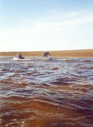
PHOTO: WERC

The Upper Kuparuk River Station is located at Latitude: 68o 38' 35" N, Longitude: 149o 24' 15" W, approximately 747 meters above sea level.

Upper Kuparuk River Station Data
Parameter CSV
File
ZIP
File
Last
Update
Discharge uk2013q.csv
uk2012q.csv
uk2011q.csv
uk2010q.csv
uk2009q.csv
uk2008q.csv
uk2007q.csv
uk2006q.csv
uk2005q.csv
uk2004q.csv
uk2003q.csv
uk2002q.csv
uk2001q.csv
uk2000q.csv
uk1999q.csv
uk1998q.csv
uk1997q.csv
uk1996q.csv
uk1995q.csv
uk1994q.csv
uk1993q.csv
uk2011q.zip
uk2010q.zip
uk2009q.zip
uk2008q.zip
uk2007q.zip
uk2006q.zip
uk2005q.zip
uk2004q.zip
uk2003q.zip
uk2002q.zip
uk2001q.zip
uk2000q.zip
uk1999q.zip
uk1998q.zip
uk1997q.zip
uk1996q.zip
uk1995q.zip
uk1994q.zip
uk1993q.zip
2/3/2015
Please visit NSF Arctic Data Center for archived dataset

General Reference Format

If you use any of the data presented in this website, we ask you to please reference the author in the following suggested format:

Kane, D.L. and Hinzman, L.D., [year of retrieval], Climate data from the North Slope Hydrology Research project. University of Alaska Fairbanks, Water and Environmental Research Center. URL: http://ine.uaf.edu/werc/projects/NorthSlope/ Fairbanks, Alaska, variously paged. [month and day of retrieval].


Return to Main WERC page
If you have any questions or comments about this project, contact:

Douglas L. Kane
(ffdlk@uaf.edu)
Tel: (907) 474-7808
Larry D. Hinzman
(ffldh@uaf.edu)
Tel: (907) 474-7331
All At:
Water and Environmental Research Center
University of Alaska Fairbanks
Fairbanks, Alaska 99775
Fax: (907) 474-7979


These pages are best viewed with Netscape Ver.2+, or Internet Explorer Ver.3+

URL: http://ine.uaf.edu/werc/projects/NorthSlope/upper_kuparuk/uk_river/uk_river.html