WERC- North Slope Hydrology Research Projects

Eastern Kuparuk Sites Information

UAF, Water and Environmental Research Center logo
Site Map:
Imnavait Watershed Sites  
Graphic bullet to indicate selection itemSite Information Graphic bullet to indicate selection itemBasin
Graphic bullet to indicate selection itemRidge
Graphic bullet to indicate selection itemValley
Graphic bullet to indicate selection itemFlume
Graphic bullet to indicate selection itemInstrumentation  
Graphic bullet to indicate selection itemImages

Upper Kuparuk Watershed Sites  
Graphic bullet to indicate selection itemSite Information
Graphic bullet to indicate selection itemU.K. Met
Graphic bullet to indicate selection itemU.K. River
Graphic bullet to indicate selection itemNorth Headwater
Graphic bullet to indicate selection itemEast Headwater
Graphic bullet to indicate selection itemWest Headwater
Graphic bullet to indicate selection itemUpper Headwater
Graphic bullet to indicate selection itemGreen Cabin Lake
Graphic bullet to indicate selection itemInstrumentation 
Graphic bullet to indicate selection itemImages

Western Kuparuk Sites  
Graphic bullet to indicate selection itemSite Information
Graphic bullet to indicate selection itemWest Kuparuk
Graphic bullet to indicate selection itemInstrumentation  
Graphic bullet to indicate selection itemImages

Eastern Kuparuk Sites  
Graphic bullet to indicate selection itemSite Information
Graphic bullet to indicate selection itemSagwon
Graphic bullet to indicate selection itemFranklin Bluffs
Graphic bullet to indicate selection itemInstrumentation  
Graphic bullet to indicate selection itemImages

Coastal Plain Sites  
Graphic bullet to indicate selection itemSite Information
Graphic bullet to indicate selection itemBetty Pingo
Graphic bullet to indicate selection itemWest Dock
Graphic bullet to indicate selection itemPutuligayuk River
Graphic bullet to indicate selection itemInstrumentation  
Graphic bullet to indicate selection itemImages

General Info  
Graphic bullet to indicate selection itemNorth Slope Hydrology
Graphic bullet to indicate selection item Main Page Graphic bullet to indicate selection itemIntroduction
Graphic bullet to indicate selection itemReferences
Graphic bullet to indicate selection itemSite Usage Statistics
Graphic bullet to indicate selection itemWERC Home
Graphic bullet to indicate selection itemRelated Links
Photo of wetlands with Franklin Bluffs in background,  - 25826 Bytes
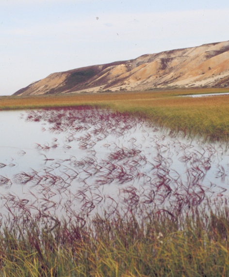
PHOTO: Larry Hinzman, WERC

WERC has two monitoring sites on the eastern border of the Kuparuk River watershed:

  • Sagwon monitoring station, located at 69o 25' 27.5" N latitude and 148o 41' 45.1" W longitude; and
  • Franklin Bluffs monitoring station, located at 69o 53' 31.8" N latitude and 148o 46' 4.8" W longitude

The Sagwon site was established on a hilltop near the Sagwon Bluffs approximately 100 km south of Prudhoe Bay. This site is located in a transitional zone between coastal plain and the foothills at an elevation of 300 m. The vegetation is characteristic of tussock tundra. The soils are loamy with a peaty surface layer and poorly drained (Everett, 1980). Instrumentation for measuring soil temperatures and meteorologic conditions was installed near the top of a 10% north-facing slope. The depth of thaw above permafrost is typically about 50 cm.

The Franklin Bluffs site was established on the coastal plain 50 km south of Prudhoe Bay. This site is located near the base of the Franklin Bluffs formation, in the relatively flat area of the Sagavanirktok River flood plain at an elevation of 78 m. The vegetation is comprised of a continuous cover of grasses and sedges rooted in mosses and lichens (Komarkova and Webber, 1980). The soils are poorly drained and generally do not thaw to depths of more than 50 cm. Organic materials of variable thickness overlie silt-loam textured mineral soils (Everett, 1980). The maximum depth of soil thawed above the permafrost averaged 66 cm between 1996 and 1999 (Brown and Hinkel, 2000)

The meteorological, hydrological and soil data archived here represents a continuous record of the Sagwon and Franklin Bluffs monitoring stations since 1986. Both sites have complete meteorological stations. Variables measured at these met stations are wind speed, relative humidity and air temperature at three elevations (with the maximum at 10 m). Wind direction, rainfall and soil temperatures are also measured. Incoming and outgoing long and short wave radiation are measured from before snowmelt until freeze-up. The water equivalent of the snowpack is measured late each spring. (Kane et al. 2000).

Brown J. and K. Hinkel, 2000. Circumpolar Active Layer Monitoring (CALM) Network. http://www.geography.uc.edu/~kenhinke/CALM/sites.html.

Everett, K.R. 1980. Soils and Mapping. In-- Environmental Engineering and Ecological Baseline Investigations along the Yukon River-- Prudhoe Bay Haul Road. J. Brown and R.L. Berg (Eds.) CRREL Report No. 80-19. Cold Regions Research and Engineering Laboratory. U.S. Army Corps of Engineers, Hanover, New Hampshire, pp. 48-52.

Kane, D.L., Hinzman, L.D., McNamara, J.P., Zhang, Z., and Benson, C.S. (2000)An Overview of a Nested Watershed Study in Arctic Alaska, Nordic Hydrology, Vol. 31 (4/5), 245-266.

Komarkova, V. and P.J. Webber. 1980. Vegetation, In--Environmental Engineering and Ecological Baseline Investigations along the Yukon River-- Prudhoe Bay Haul Road. J. Brown and R. L. Berg (Editors). CRREL Report No. 80-19. Cold Regions Research and Engineering Laboratory, U.S. Army Corps of Engineers, Hanover, New Hampshire, p. 37-42.


Sagwon Station data
Updated 02/02
Franklin Bluffs Station data
Updated 02/02
--
Instrumentation
Information
Updated 02/02
E-Kuparuk Images
Updated 02/02
Watershed
Comparisons
Updated 02/02


Return to Main WERC page
If you have any questions or comments about this project, contact:

Douglas L. Kane
(ffdlk@uaf.edu)
Tel: (907) 474-7808
Larry D. Hinzman
(ffldh@uaf.edu)
Tel: (907) 474-7331
All At:
Water and Environmental Research Center
University of Alaska Fairbanks
Fairbanks, Alaska 99775
Fax: (907) 474-7979


These pages are best viewed with Netscape Ver.2+, or Internet Explorer Ver.3+

URL: http://ine.uaf.edu/werc/projects/NorthSlope/e_kuparuk/e_kuparuk.html