|
|
||||||||
|
|
||||||||
|
|
Sagavanirktok River/Bullen Point
|
|||||||
| Summary | Network Map | Stations | Reports | Lake Info | Sponsors | Contacts |
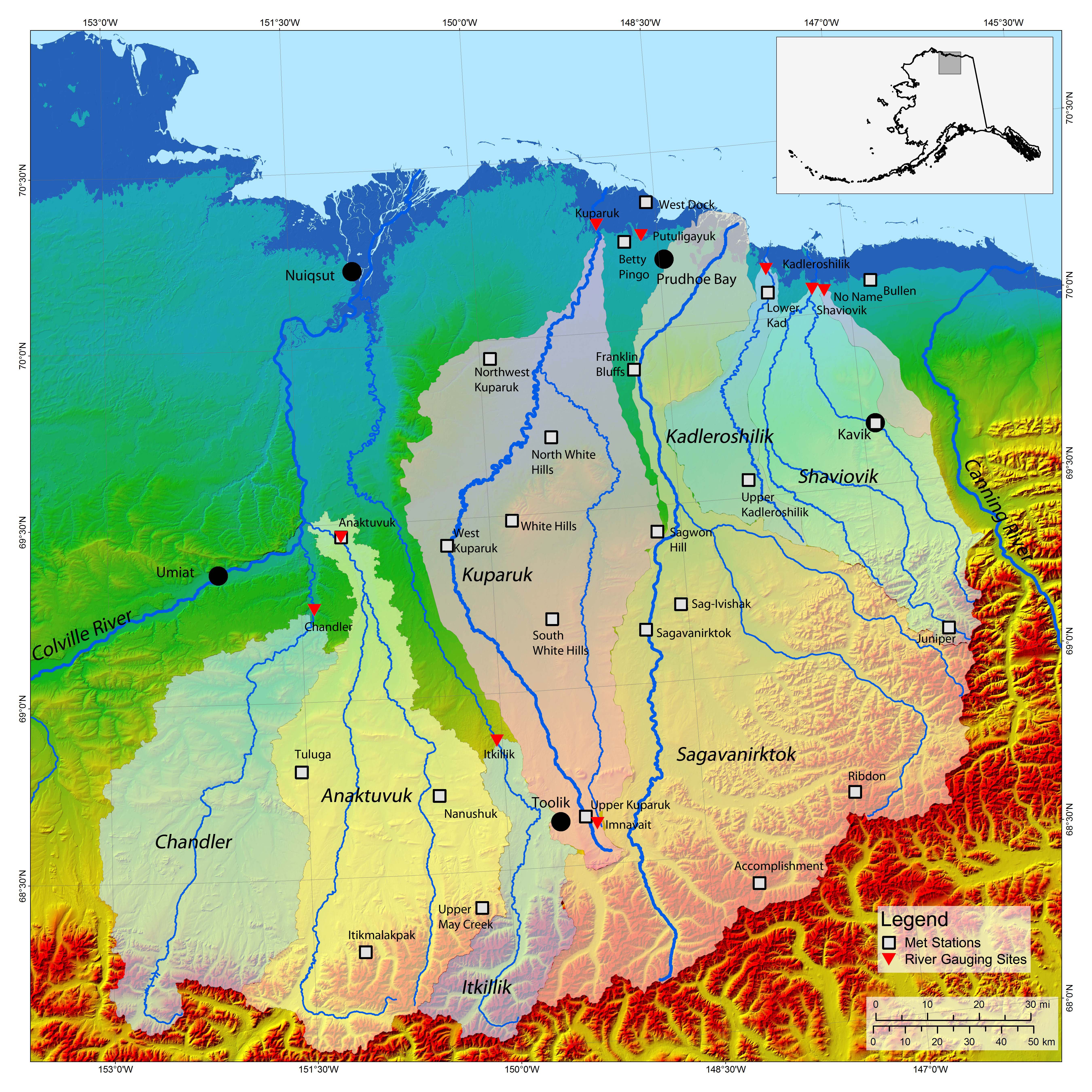
Click here for a map showing the study area and station locations.
The watersheds in the area between the Sagavanirktok River and Bullen Point extend south into the Brooks Range. This is an area with no history of weather, climate, or hydrologic long-term data stations. A network of meteorological and hydrologic data stations has been established in 2006 to help provide information needed for engineering design, tundra travel opening and closing, natural resource management and protection, and public safety. Snow on the Arctic Slope of Alaska lasts up to nine months a year. Water contained in snowpack ensures that snowmelt is a major hydrological event each year. Peak discharge resulting from snowmelt is the highest for many rivers on the North Slope, particularly for the largest basins like the Colville, Sagavanirktok and Kuparuk Rivers. Rivers flowing into the Beaufort Sea drain a large area that extends from the Brooks Range through the Northern Foothills and across the Coastal Plain before discharging into the Arctic Ocean. Information from the project data network will help understand the important processes in these arctic hydrologic systems.
| Copyright © 2006 Water and Environmental Research Center |