|
Sagavanirktok River/Bullen Point
Hydrology Project Summary
This project, funded by the State of Alaska through the Department of Natural Resources (AKDNR),
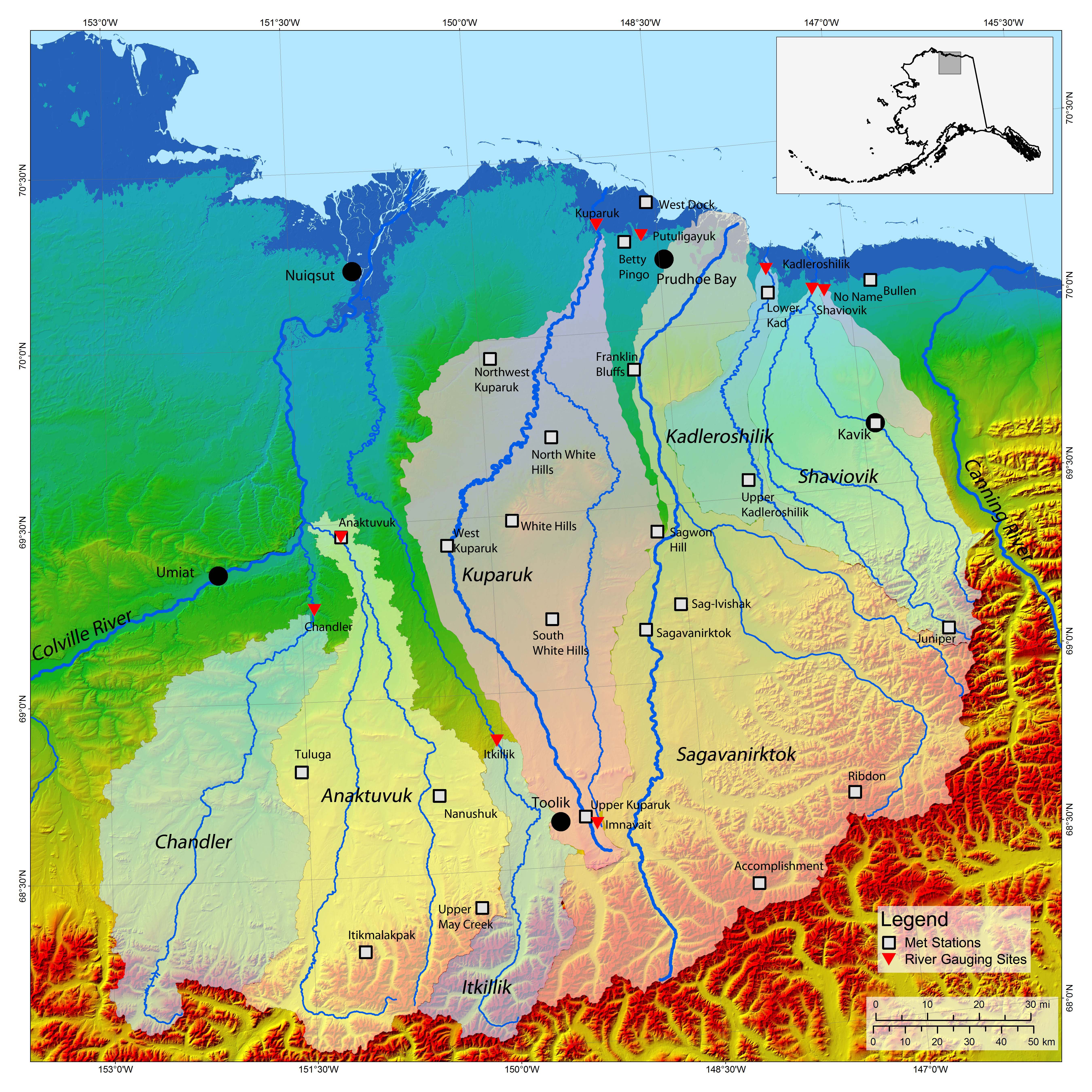
ended in July of 2010. The purpose of the project was to investigate the hydrology in the coastal plain region from the Sagavanirktok
River toward Bullen Point. This is a data-sparse region; issues such as
breakup timing, prediction of flood events, estimating potential recharge
and impacts of water use from lakes and gravel pits require a better understanding
of water resources in the area. It is also important to develop an understanding
of how the related watersheds function relative to the Kuparuk River Watershed,
which has the longest-term data on the North Slope and has the greatest
potential for serving as an index watershed. Developing this understanding
will help better define the risks associated with hydrologic variability
and climate change impacts in areas with no historical hydrologic information.
The Bullen Point project links will take you to project reports, archived hydro-meteorological data collected from eight weather stations and three river gauging stations, regional hydrology references, and project staff
contact information.
A final project report will be posted soon. Click here for a map showing the study area and station locations. |