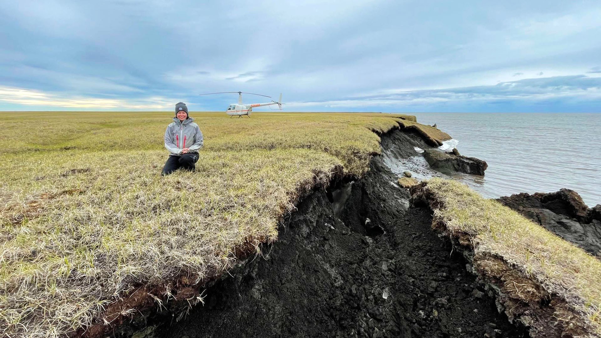
A study led by INE researcher Melissa Ward Jones (Water and Environmental Research Center) recently published in Scientific Reports combined high resolution image datasets to create a 15 timestep record analyzing coastal erosion processes at Drew Point on the Beaufort Sea Coast.
The high-resolution imagery was used to analyze erosion mechanisms in relation to environmental forcings along a 1.5 km stretch of coastline for the 2018 and 2019 open water seasons and enabled the quantification of erosion mechanisms (block failure and thermal denudation) by incorporating environmental parameter data from a nearby USGS automatic weather station.
The study also developed a new metric called wind sums, that combines wind speed and directional data. It was effective in correlating erosion as it can be used as a proxy for integrated storm intensity and can also incorporate lagged erosion responses.
This project was conducted in collaboration with Benjamin Jones (INE Water and Environmental Research Center) as well as researchers from the Alfred Wegener Institute, b.geos, and Sandia National Laboratory.
Ward Jones' research was featured in a blog series of the NSF Arctic Data Center.
Recently published:
Ward Jones, M. K., Jones, B. M., Nitze, I., Gessner, M., Grosse, G., Bartsch, A., and Bull, D. (2025). Annual and sub-seasonal dynamics of a rapidly eroding permafrost coastline along the Beaufort Sea Coast in northern Alaska. Scientific Reports, 15: 19798.
Image top: Melissa Ward Jones sits at the bluff edge at Drew Point, Alaska next to a collapse permafrost block in July 2021. UAF/INE photo by Benjamin Jones.
2026
March
2025
December
November
October
September
August
July
February
January
2024
December
October
September
August