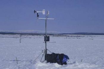
Council: C1-Grid Station

C1-Grid Tower,
Photo by UAF staff
Council site C1 is located at Latitude: 64* 50.60' N, Longitude: 163* 42.32' W, about 50 meters above sea level.
The slope at this location is approximately 0.019 m/m, east facing.
The vegetation at this site is tussock tundra and moss.
The station is located on the west side of the road four miles south of Council, within a CALM (Circumpolar Active Layer Monitoring) Grid. Map Info: (Solomon D-4, T 7 S, R 25 W, Sec 34).

