
Council Site Description
C2-Blueberry,
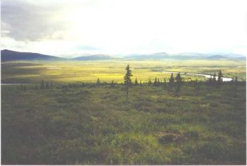
Photo by UAF staff
The Council area is representative of subarctic transitional regions where boreal forests give way to tundra regions located on warm permafrost. In terms of scientific research, this region provides a smooth link to the well developed tussock tundra currently being studied at Kougarok.
The Council Site is easily accessable by road (80 miles) from Nome in the summer. The road ends at the Niukluk River and the town of Council is located on the far side. The river can usually be forded using a 4 wheel drive truck, except at times of high flow. All weather stations and stream gaging sites are within walking distance of the road. It is possible to arrage with the locals to rent a home in Council to use as a camp. Winter access is by chartered airplane or helicopter, or by snowmachine from Nome.
In Summer 1999, three ATLAS weather stations were installed - one 3 m tower (C1-Grid) in a lowland moss/tussock area that appears to be heavily thermokarsting conditions, one 10 m tower (C2-Blueberry) near the top of a hill in the Melsing Creek drainage representing well drained moss/lichen vegetation, and one 3 m tower (C3-Guy Rowe) in the Guy Rowe Creek drainage, representing upland tundra. Additionally, a 1 km x 1 km grid was installed as part of the Circumpolar Active Layer Monitoring (CALM) program, which is an effort to monitor changes in the thickness of the active layer above permafrost. The first two stations are still actively used for research. The Guy Rowe site was frequently visited by animals and was removed in 2004.
