| Ivotuk Site
Kougarok Site Council Site General Info |
 |
|
|
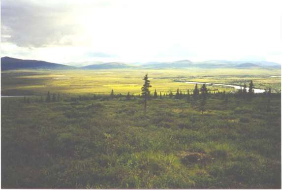
The Council area is representative of subarctic transitional
regions where boreal forests give way to tundra regions located on warm permafrost.
In terms of scientific research, this region provides a smooth link to the
well developed tussock tundra currently being studied at Kougarok.
The Council Site is easily accessable by road (80 miles) from Nome in the
summer. The road ends at the Niukluk River and the town of Council is located
on the far side. The river can usually be forded using a 4 wheel drive truck,
except at times of high flow. All weather stations and stream gaging sites
are within walking distance of the road. It is possible to arrage with the
locals to rent a home in Council to use as a camp. Winter access is by chartered
airplane or helicopter, or by snowmachine from Nome.
Two watersheds in the Council area are being studied. Melsing Creek (80.6
km2), to the immediate east of town, is the primary focus. This watershed
is in an area of discontinuous permafrost, and contains a broad variation
in substrate and vegetation types. The watershed contains a mix of tussock
tundra, small shrubs and black spruce. It also contains a complete meteorological
station and discharge monitoring station during the summer months. This is
the warmest watershed included in the ATLAS study, with the largest proportion
of discontinuous permafrost. Groundwater processes more predominantly influence
this watershed as compared to the others. Groundwater wells for monitoring
subsurface hydrologic processes will be installed in August 2000.
The other watershed of interest, Guy Rowe Creek (6.65 km2), is about 12 miles
south of Council. Guy Rowe Creek is similar to Melsing Creek, but also has
upland characteristics such as steeper slopes, less vegetation and increased
orographic weather effects.
In Summer 1999, three ATLAS weather stations were installed - one 3 m tower
(C1) in a lowland moss/tussock area that
appears to be heavily thermokarsting, one 10 m tower (C2)
near the top of a hill in the Melsing Creek drainage representing well drained
moss/lichen vegetation, and one 3 m tower (C3)
in the Guy Rowe Creek drainage, representing upland tundra. Additionally,
a 1 km x 1 km grid was installed as part of the Circumpolar
Active Layer Monitoring (CALM) program, which is an effort to monitor
changes in the thickness of the active layer above permafrost.
Council Research Survey Spring 2001
| C 2 Data |
C 3 Data | |
| Instrumentation Information |
Council Images |
Watershed Comparison |
(ffldh@uaf.edu) Tel: (907) 474-7331 |
(ffdlk@uaf.edu) Tel: (907) 474-7808 |
(ffdjg@uaf.edu) Tel: (907) 474-5059 |