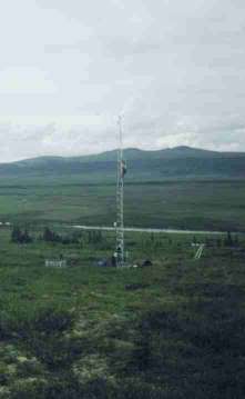
| Ivotuk Site
Kougarok Site Council Site General Info |
 |
Council site C2 is located at Latitude:
64* 53.47' N, Longitude: 163* 38.61' W, about 140 meters above sea level.
The slope at this location is approximately 0.113 m/m, south facing.
The vegetation at this site is tussock tundra and moss. This station
is located 1/2 mile east of Council on a south slope of Blueberry Hill.
Map info: (Solomon D-4, T 7 S, R 25 W, Sec 12)
| Parameter | CSV File |
Last Update |
| Meteorological Data |
c2_met_1999.csv c2_met_2000.csv c2_met_2001.csv c2_met_2002.csv c2_met_2003.csv c2_met_2004.csv c2_met_2005.csv c2_met_2006.csv c2_met_2007.csv c2_met_2008.csv |
March 2009 |
| Soils Data |
c2_soil_1999.csv c2_soil_2000.csv c2_soil_2001.csv c2_soil_2002.csv c2_soil_2003.csv c2_soil_2004.csv c2_soil_2005.csv c2_soil_2006.csv c2_soil_2007.csv c2_soil_2008.csv |
March 2009 |
| Radiation Data |
c2_rad_1999.csv c2_rad_2000.csv c2_rad_2001.csv c2_rad_2002.csv c2_rad_2003.csv c2_rad_2004.csv c2_rad_2005.csv c2_rad_2006.csv c2_rad_2007.csv c2_rad_2008.csv |
March 2009 |