Site Map: |
| Imnavait Watershed Sites
Upper Kuparuk Watershed Sites Western Kuparuk Sites Eastern Kuparuk Sites Coastal Plain Sites General Info |

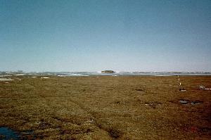
PHOTO: WERC The Betty Pingo Station is located at Latitude: 70o 16' 46.3" N, Longitude: 148o 53' 44.5" W about 11.6 meters above sea level. A met station is located at the center of the 8.15 ha. watershed. Radiation and soil temperature information is collected over a wet, marshy location by the main meteorological tower (Betty Wetland/Met) and also from a drier, higher location a few meters away (Betty Upland). The Betty Upland radiation tower coordinates are: 70o 16' 46.9" N and 148o 53' 46.5" W. The study site raingage is located at the Betty Upland Site. Continuous soil moisture data is also collected via a Time Domain Reflectometry (TDR) unit (located at 70o 16' 46.7" N and 148o 53' 46" W). |
||||||||||||||||
|
||||||||||||||||
|
||||||||||||||||
General Reference FormatIf you use any of the data presented in this website, we ask you to please reference the author in the following suggested format:Kane, D.L. and Hinzman, L.D., [year of retrieval], Climate data from the North Slope Hydrology Research project. University of Alaska Fairbanks, Water and Environmental Research Center. URL: http://ine.uaf.edu/werc/projects/NorthSlope/ Fairbanks, Alaska, variously paged. [month and day of retrieval]. |