![]()
About the Caribou-Poker Creeks Research Watershed.
This page created by John G. Irons III for Website http://www.lter.uaf.edu.
The Caribou-Poker Creeks Research Watershed (CPCRW) is a 104 km2 basin near Chatanika, Alaska reserved for ecological, hydrological, and climatic research. It is owned jointly by the State of Alaska and the University of Alaska Fairbanks. The entrance to the Research Watershed is located on the Steese Highway about 31 miles from Fairbanks. Access is restricted, and permission for access or to conduct research can be obtained by contacting the lead Principal Investigator, Terry Chapin, or the Data Manager, Darrell Blodgett.
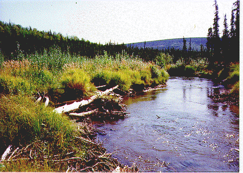
Lower Poker Creek, below the confluence with Caribou Creek. Poker Creek is a fourth-order stream at this point. On the left is a riparian zone of felt-leaf willow (Salix alaxensis) and blue-joint grass (Calamagrostis canadensis), and on the right, the river butts up against mature white spruce (Picea glauca) forest.
About the Research Watershed
LTER Aquatic Research
Other Relevant or Interesting Links