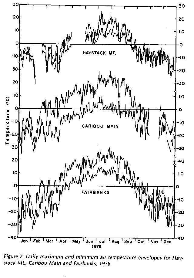
The Caribou-Poker Creeks Research Watershed (CPCRW) is about 50 km northeast of Fairbanks and slightly higher in elevation (210 m at the lowest point) than the Fairbanks International Airport, where Fairbanks weather data are collected. Hence, temperature and precipitation are also slightly different. The figure below shows daily minimum and maximum air temperatures at the Fairbanks airport, in the Caribou Creek valley bottom, and at the top of Haystack Mountain, at 775 m (check this!) on the western boundary of CPCRW. Note that the daily range is less on Haystack Mountian, but greater at Caribou Main, than at Fairbanks. Although summer temperatures are colder on Haystack than at Caribou Main, winter temperatures are warmer, and the mean annual temperature (1975-1979) was -3.3oC on Haystack and -4.9oC at Caribou Main. The long-term mean annual temperature at Fairbanks is -3.5oC (Haugen et al. 1982).