|
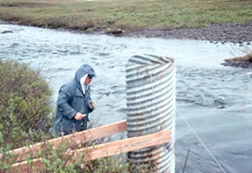
Upper Kuparuk River Stream Gage
|
|
|
upstream of Dalton Hwy bridge
|
|
| Date: |
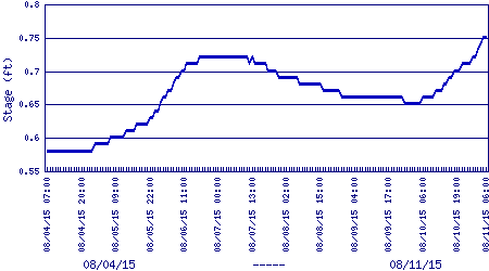
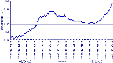
Tuesday, August 11, 2015, 6:30 AM AST
|
|
| Stage1: |
0.76 ft
|
|
| Stage2: |
3.28 ft
|
|
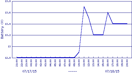
| Battery Voltage: |
12.7 V
|
|
|
|
|
|
|
 |
|
Archived Site Photograph
|
*These values are averaged over the one hour preceding the recorded time.
NOTICE: This information is provisional and raw; data are not yet validated
or otherwise checked.
WERC 10m met & soil sites in the Kuparuk River watershed:
Imnavait Basin,
Upper Kuparuk,
West Kuparuk,
Sagwon Hill,
Franklin Bluffs,
Betty Pingo,
West Dock
WERC precip data sites in the Kuparuk River watershed headwaters:
North HW,
East HW,
Upper HW,
West HW,
Green Cabin Lake
WERC seasonal gaging stations in the Kuparuk & Putuligayuk River watersheds:
Upper Kuparuk River,
Imnavait Creek flume,
Putuligayuk River
WERC communications repeater & base sites in the Kuparuk River watershed:
Slope Mtn,
Sagwon summit,
Slope Mtn/Sag River DOT&PF Station (netcam)
Other WERC environmental data networks with near-real-time data:
Seward Penninsula,
Caribou Poker Creek Research Watershed
If you have any questions or comments about this project, contact:
at:
Water and Environmental Research Center
University of Alaska Fairbanks
Fairbanks, Alaska 99775
Fax: (907) 474-7979

|
Copyright 2002,
Water & Environmental Research Center, UAF
|

|
URL: