|
70 16 46.3 N 148 53 44.5 W 11.6 m ASL
|
||
| Date: |
Tuesday, October 18, 2011, 12:00 PM AST
|
|
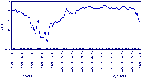
| Air Temperature: |
-4.786 C, 23.4 F
|
|
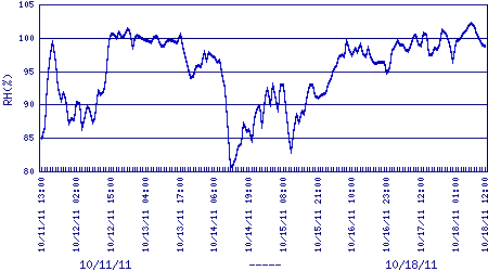
| Relative Humidity: |
98.7 %
|
|
| Dewpoint: |
-5.0 C, 23.1 F
|
|
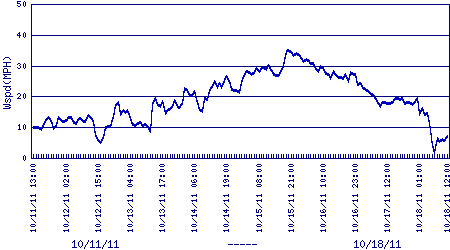
| Windspeed: |
average 6.8 mph
|
|
| Wind Direction: |
127 deg, SE |
|
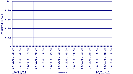
| Rainfall: |
0 mm
|
|
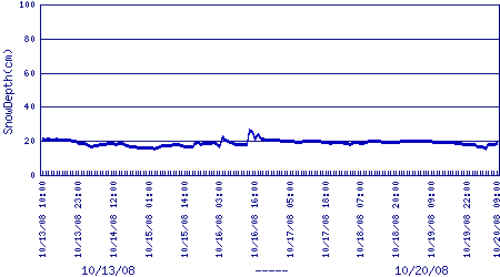
| SnowDepth: |
ERROR cm
|
|
Archived Site Photograph or Plot