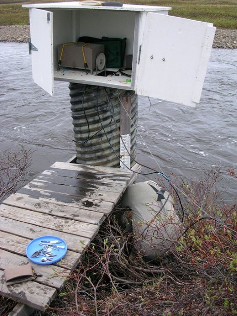
Water levels and discharge have been measured in the Upper Kuparuk River since 1993. The drainage is gauged just upstream from where the Dalton Highway crosses the river near Milepost 289. It is a north-south trending drainage of approximately 142 km2 (at the gauge site).
Manual discharge measurements are made at least daily during spring breakup, and a stage-discharge relationship (rating curve) is used to estimate runoff during the summer months. Summer discharge is manually measured 2-3 times per year to verify the rating curve. River stage is measured with pressure transducers.
If you use data presented in this website, we ask you to add a reference to your publication in the following recommended format:
Stuefer S.L. and Youcha, E.K., [year of retrieval], Hydrology of Imnavait Creek and Kuparuk River in Alaska. University of Alaska Fairbanks, Water and Environmental Research Center. [URL]. Accessed [month, day and year of retrieval].
For example: Stuefer S.L. and Youcha, E.K., 2021. Hydrology of Imnavait Creek and Kuparuk River in Alaska. University of Alaska Fairbanks, Water and Environmental Research Center. https://ine.uaf.edu/werc/imnavait. Accessed July 1, 2021.