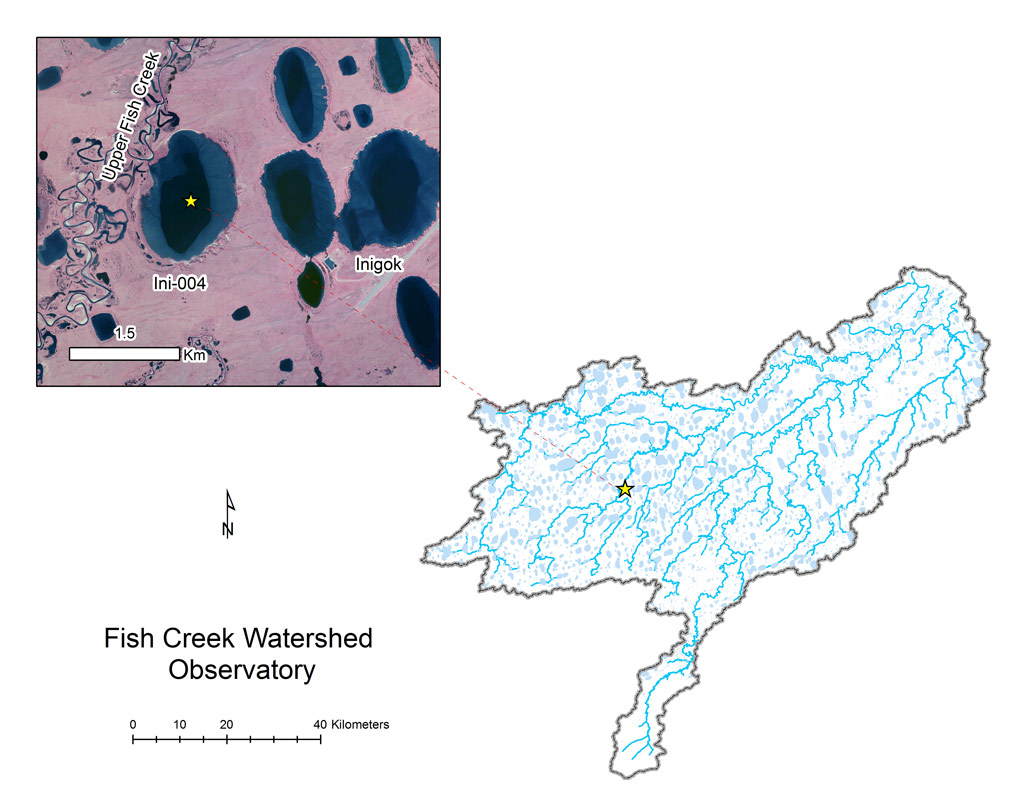
- Station Name:
- Ini-004
- Latitude:
- N 69.996°
- Longitude:
- W 152.951°
- Elevation:
- 46.9 masl
- Lake Area:
- 417 ha
- Mean Depth:
- 2.2 m
- Record:
- 2011-2014 (discontinued)
- Purpose:
The lake has sand sea shelf and trough morphology, yet troughs are relatively shallow with dense macrophyte beds. The lake is actively eroding into adjacent lake basins. This is the headwater for Judy-Kayaak Creek. This site was also part of the Circum-Arctic Lake Observation Network (CALON) from 2012-2014.
Select Published Studies on Ini-004:
- Arp, C. D., B. M. Jones, A. K. Liljedahl, K. M. Hinkel, and J. A. Welker. 2015. Depth, ice thickness, and ice-out timing cause divergent hydrologic responses among Arctic lakes. Water Resources Research. DOI:1002/2015WR017362
- Beaver, J. R., Arp, C. D., Tausz, C. E., Jones, B. M., Whitman, M. S., Renicker, T. R., Samples, E. E., Ordosch, D. M., and Scotese, K. C., 2019. Potential shifts in zooplankton community structure in response to changing ice regimes and hydrologic connectivity. Arctic, Antarctic, and Alpine Research, 51(1): 327-345.