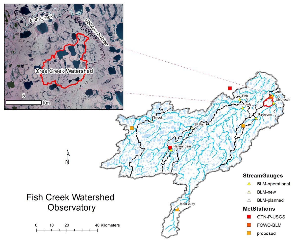
- Station Name:
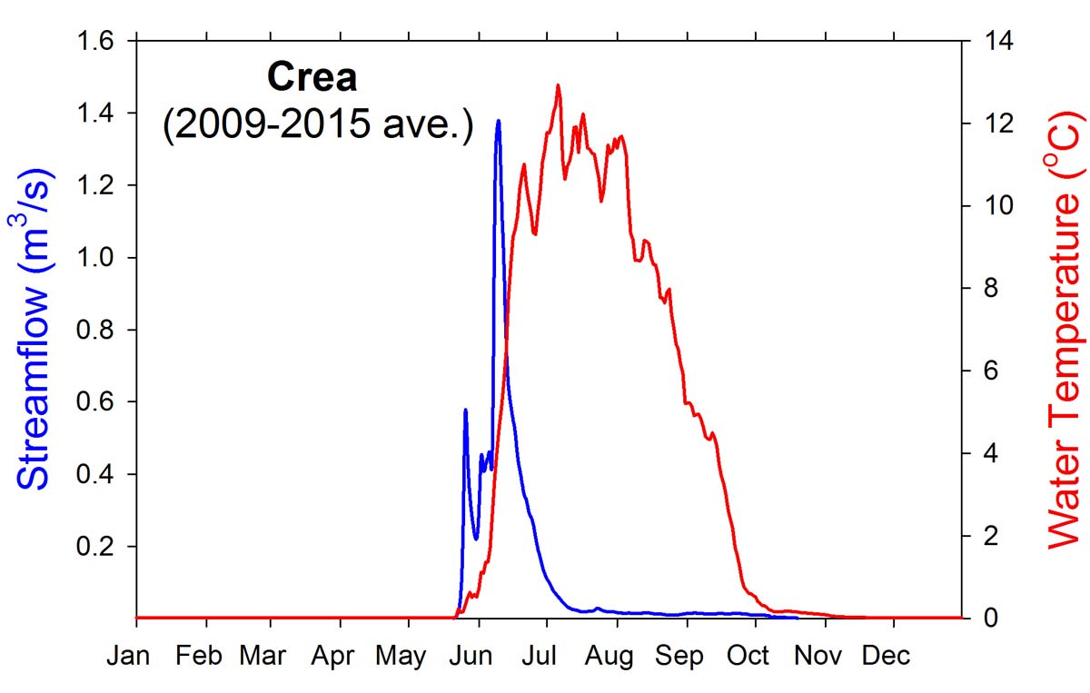
- Crea Creek
- Latitude:
- N 70.289°
- Longitude:
- W 151.312°
- Elevation:
- 3.9 masl
- Drainage Area:
- 28.9 km2
- Record:
- 2009 – present
- Purpose:
This station was established to collect baseline data prior to development of ConocoPhillips Alaska Inc.'s GMT1 (CD-6) project in which a permanent road and stream crossing are planned within this watershed. In addition to stream gauging and water quality monitoring, several fish ecology and aquatic habitat studies have been conducted in this beaded stream-thermokarst lake system as part of the FCWO.
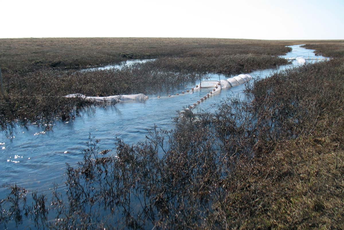
Fyke nets set in Crea Creek channel for study of Arctic Grayling migration and habitat use in late June.
Select Published Studies on Crea Creek:
- Heim, K. C., M. S. Wipfli, M. S. Whitman, C. D. Arp, J. Adams, and J. A. Falke. 2015. Environmental cues of Arctic grayling seasonal movement in a small Arctic stream: the importance of surface water connectivity. Environmental Biology of Fishes DOI 10.1007/s10641-015-0453-x
- Jones, B. M., A. Gusmeroli, C. D. Arp, T. Strozzi, G. Grosse, B. V. Gaglioti, and M. S. Whitman. 2013. Classification of freshwater ice conditions on the Alaskan Arctic Coastal Plain using ground penetrating radar and TerraSAR-X satellite data. International Journal of Remote Sensing 34(23): 8253-8265.