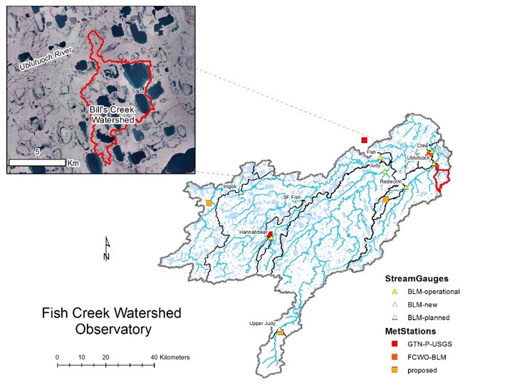
- Station Name:
- Bill's Creek
- Latitude:
- N 70.236°
- Longitude:
- W 151.274°
- Elevation:
- 8.0 masl
- Drainage Area:
- 24.6 km2
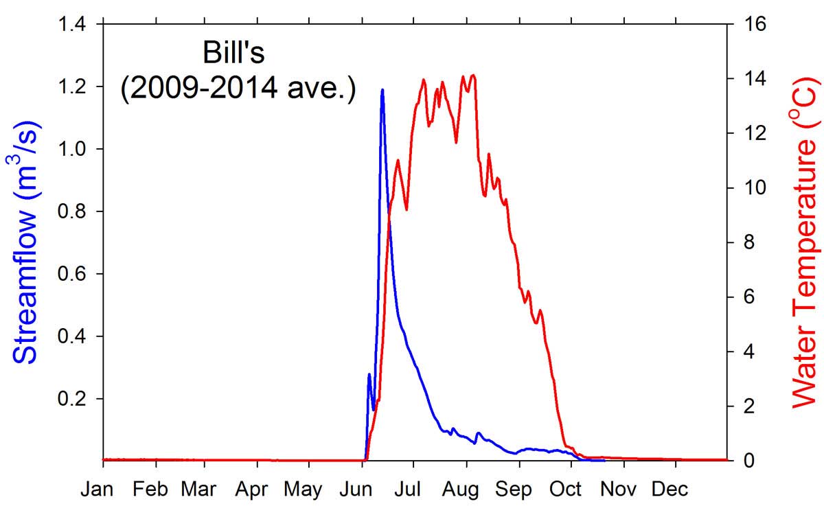
- Record:
- 2009 – 2014 (discontinued)
- Purpose:
This station was established primarily as a reference site for comparison to adjacent watersheds where development activities are occurring or being planned, such as Crea, Blackfish, and Oil creeks. This watershed is close to the Native Village of Nuiqsut and is now discontinued to reduced air travel near subsistence use areas and because a 5-yr record has been achieved. This stream is named after biologist Bill Morris formerly of ADF&G who did work in this and other waters in the area.
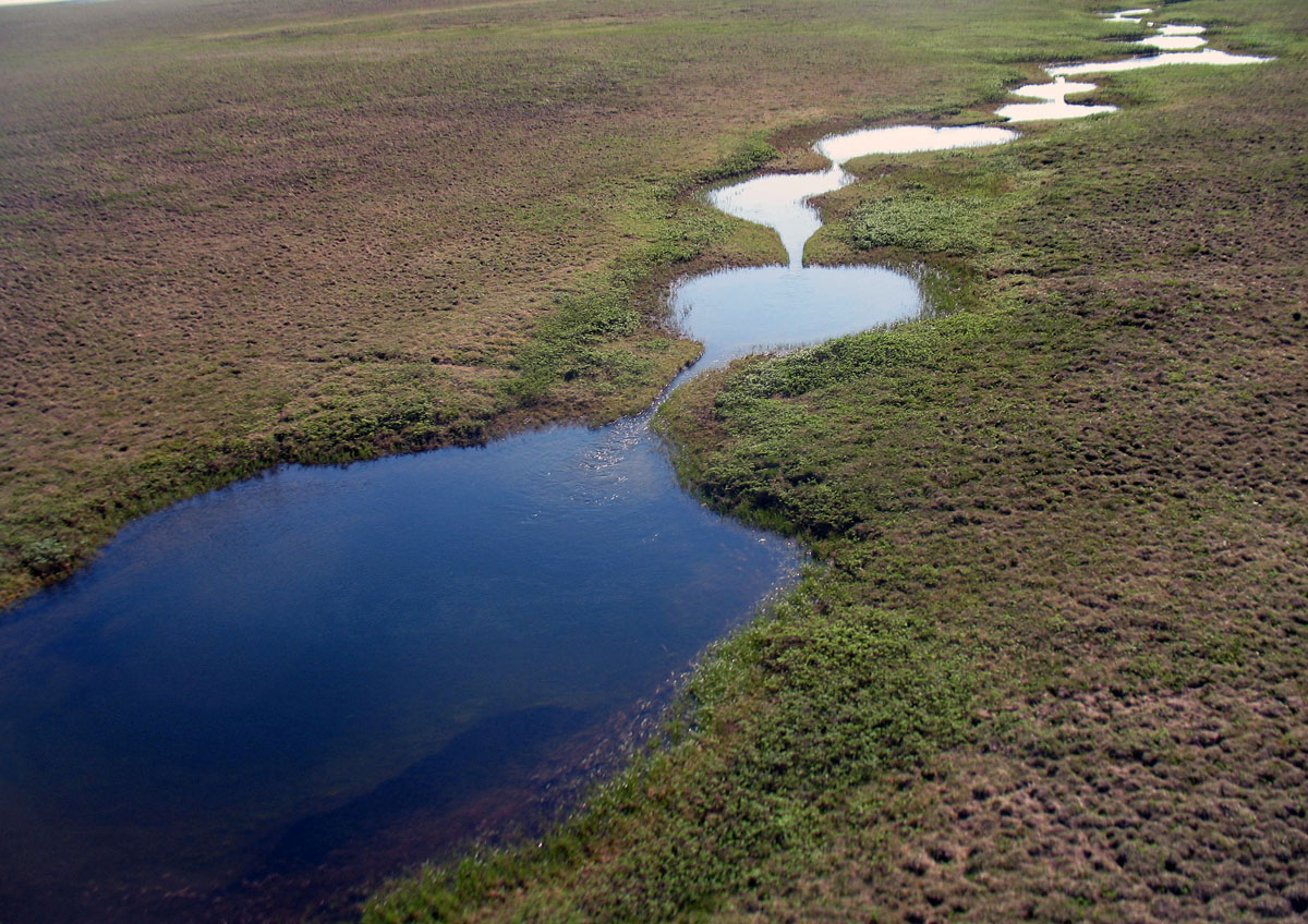
Classic beaded stream morphology of Bill’s Creek
Select Published Studies on Bill's Creek:
- Morris, W. (2003), Seasonal movements and habitat use fo Arctic grayling (Thymallus arcticus), burbot (Lota lota), and broad whitefish (Coregonus nasus) within the Fish Creek drainage of the National Petroleum Reserve - Alaska, 2001-2002.Rep., Alaska Department of Natural Resources, Office of Habitat management and Permitting.