
University of Alaska Fairbanks
|
Water and Environmental Research
Center University of Alaska Fairbanks |
|
|
|
|
Data and Pictures Pictures |
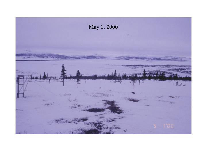
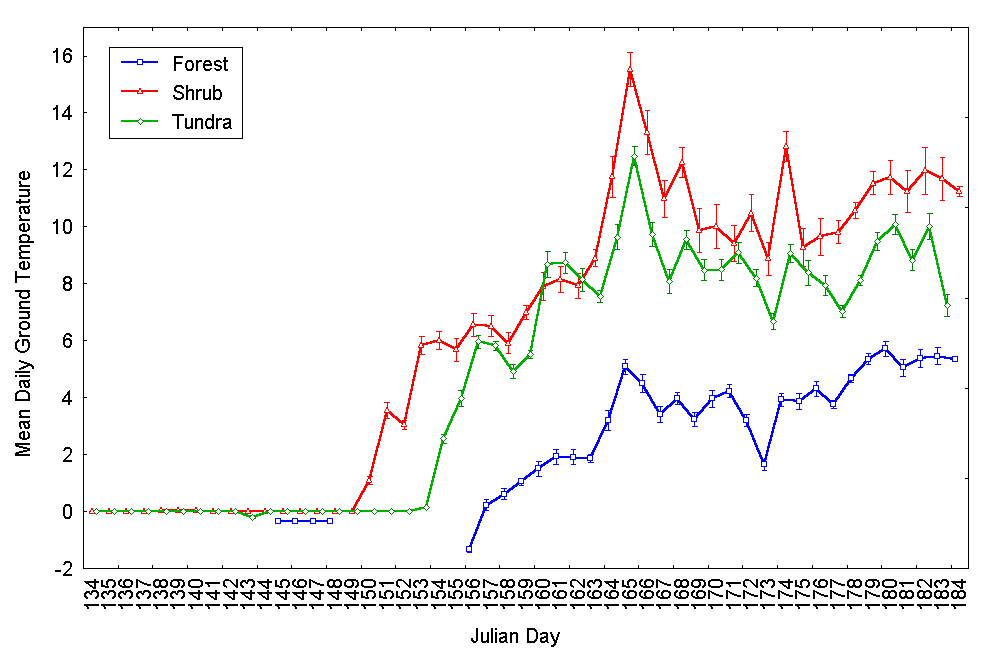
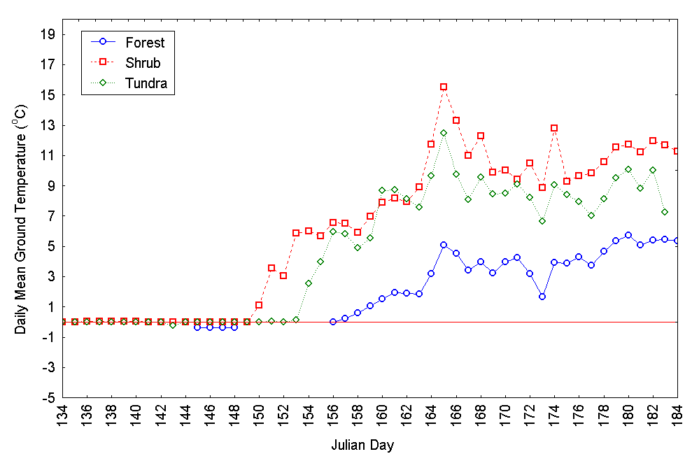
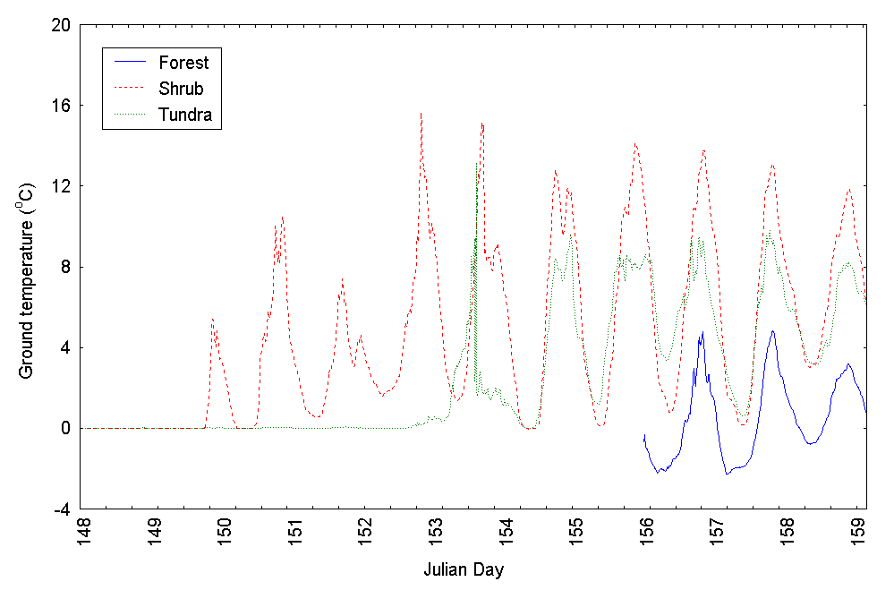
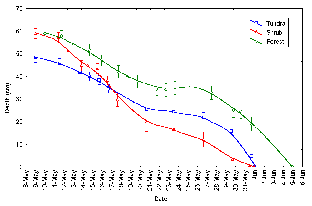
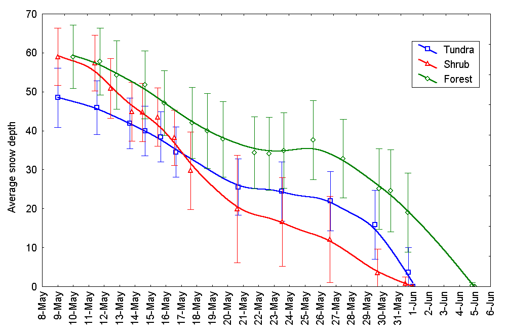
CouncilCouncil is about 80 miles by road from Nome. The study site represents a subarctic transition region where black spruce and tundra grow atop permafrost. The two watersheds being studied at Council are Melsing Creek (80.6 km^2) and Guy Rowe Creek (6.65 km^3). There are three meteorological towers located near Council. C1 is a 3 meter tower standing in a low lying moss/tussock area that seems to be thermokarsting. C2 is a 10 meter tower perched atop a hill in the Melsing Creek drainage area. C3 is a 3 meter tower located in the Guy Rowe Creek drainage area. Click the link below for a slide show summary of the site. |
| The snowmelt and meteorological data (above) collected at Council are provided courtesy of Anne Carr (ftatc@uaf.edu), Julie Knudson (fnjak2@uaf.edu) and Larry Hinzman (ffldh@uaf.edu). Please contact these individuals and credit their effort when using their data. |
| Additional Data collected by Chapin Crew. |
| The snowmelt and meteorological data (above) collected at Council are provided courtesy of Jason Beringer (beringer@lter.uaf.edu), F. Stuart Chapin (fschapin@lter.uaf.edu, and Ian D. McHugh (easymc@hotmail.com). Please contact these individuals and credit their effort when using their data. |