|


Physical, Biological and Chemical Implications of Mid-Winter Pumping of Tundra Lakes
|
Station Name:
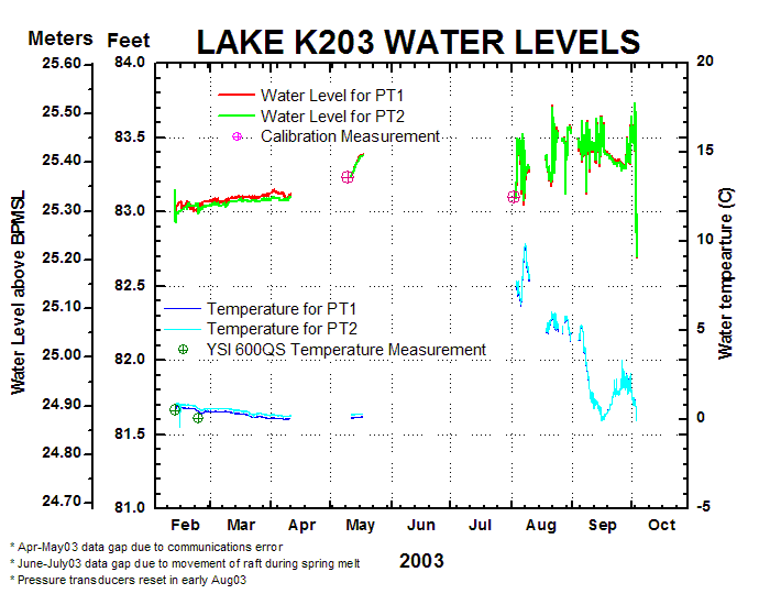
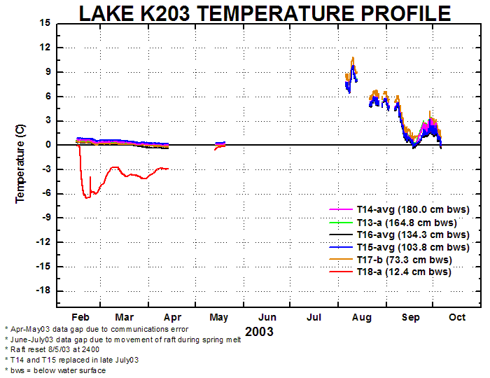
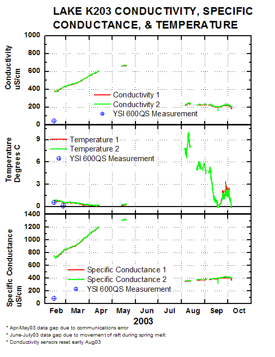
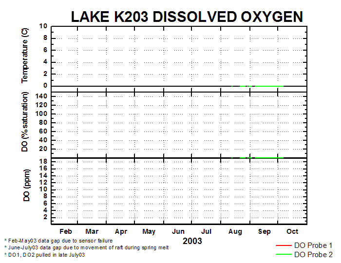
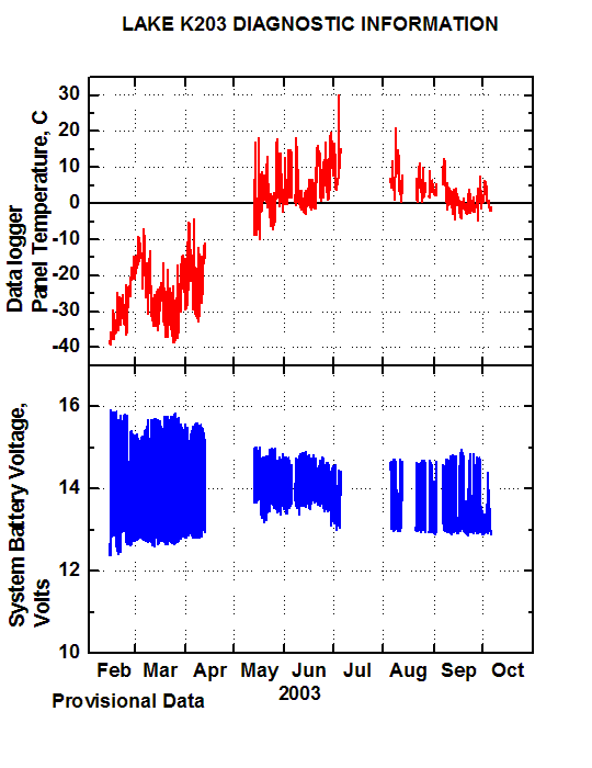
Lake k203
Location: 70° 17'07.6" N 149° 51'39.5" W
Elevation: 83.10 ft
Sensor Height:
All sensors are near the bottom of the lake
Please see data plots and data files for specific sensor depths
Notes: None at this time
 |
Elevation
measured from BP mean sea level |
|
Datum
Used: NAD 27 |
|
|
|
|
Historical Data
|
Photo Gallery
|
|
|
|
Historical Data
|
|
URL:
http://ine.uaf.edu/werc/projects/NorthSlope/lake_recharge/k203/k203historical.html
|