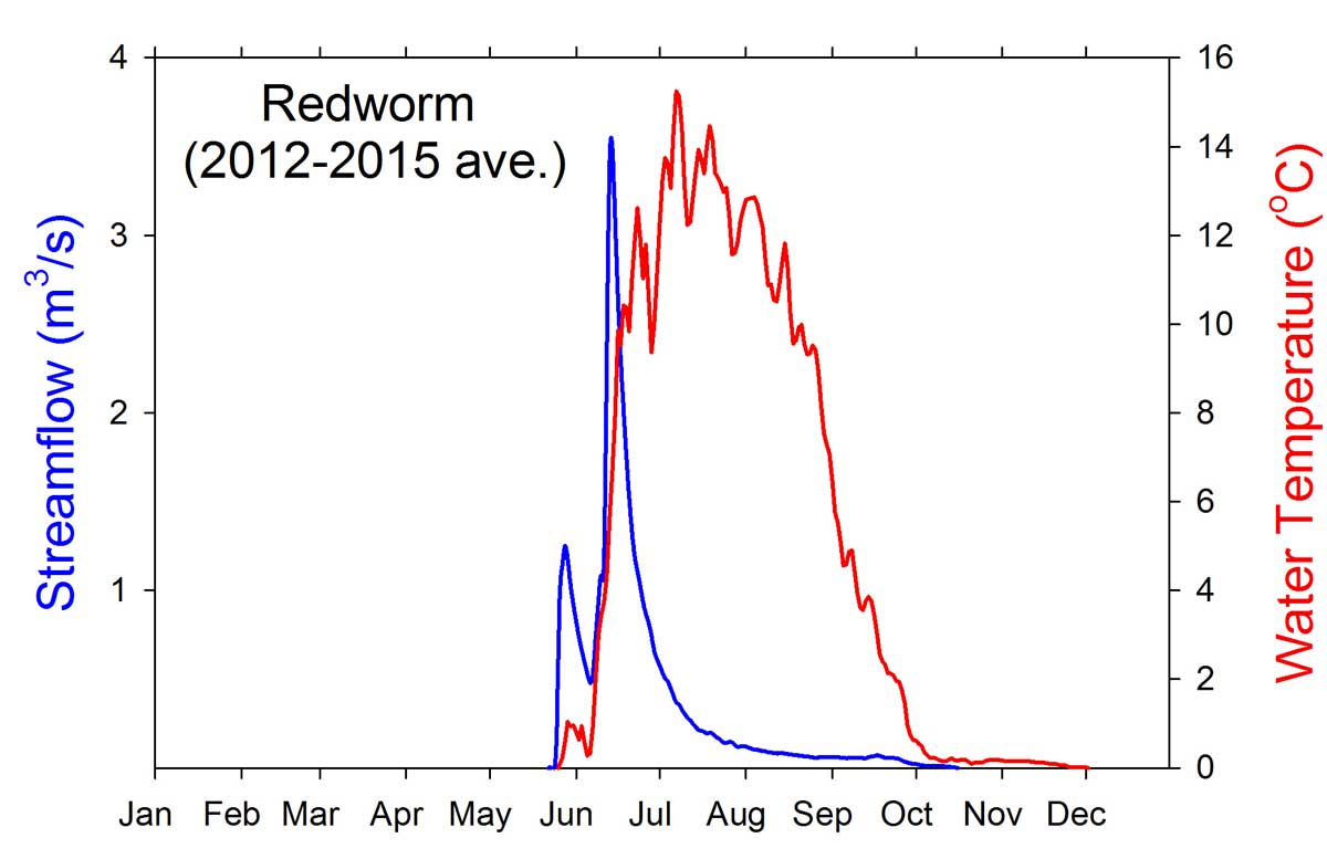
- Station Name:
- Redworm Creek
- Latitude:
- N 70.158°
- Longitude:
- W 151.610°
- Elevation:
- 14.8 masl
- Drainage Area:
- 64.3 km2
- Record:
- 2012 – 2015 (no record for 2014)
- Purpose:
This station was established to collect baseline data in response to new exploration and proposed plans for ConocoPhillip Alaska Inc.’s GMT-2 project that would occur within this watershed. This watershed is larger than others being monitored for this project and is fed by several flowthrough lakes that are being studied for this and other projects. The stream was named for the collection of an Oligochaete sp. with a strong crimson color in the upstream Redworm Lake.

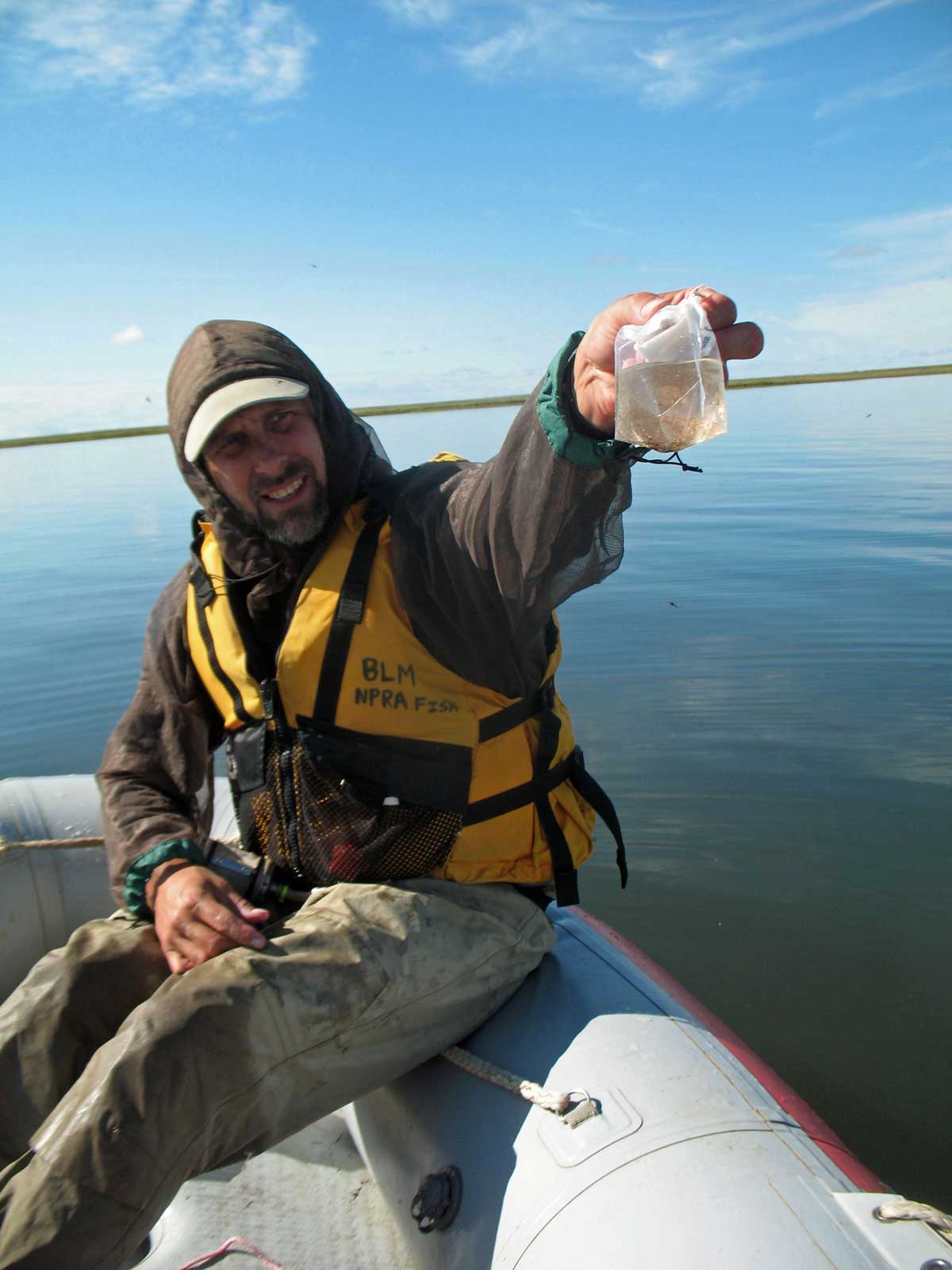
Limnological sampling at Redworm Lake.
Select Published Studies on Redworm Creek and its Lakes:
- Leppi, J. C., C. D. Arp, and M. S. Whitman. 2015. Predicting late winter dissolved oxygen levels in Arctic lakes using morphology and landscape metrics. Environmental Management. DOI:10.1007/s00267-015-0622-x