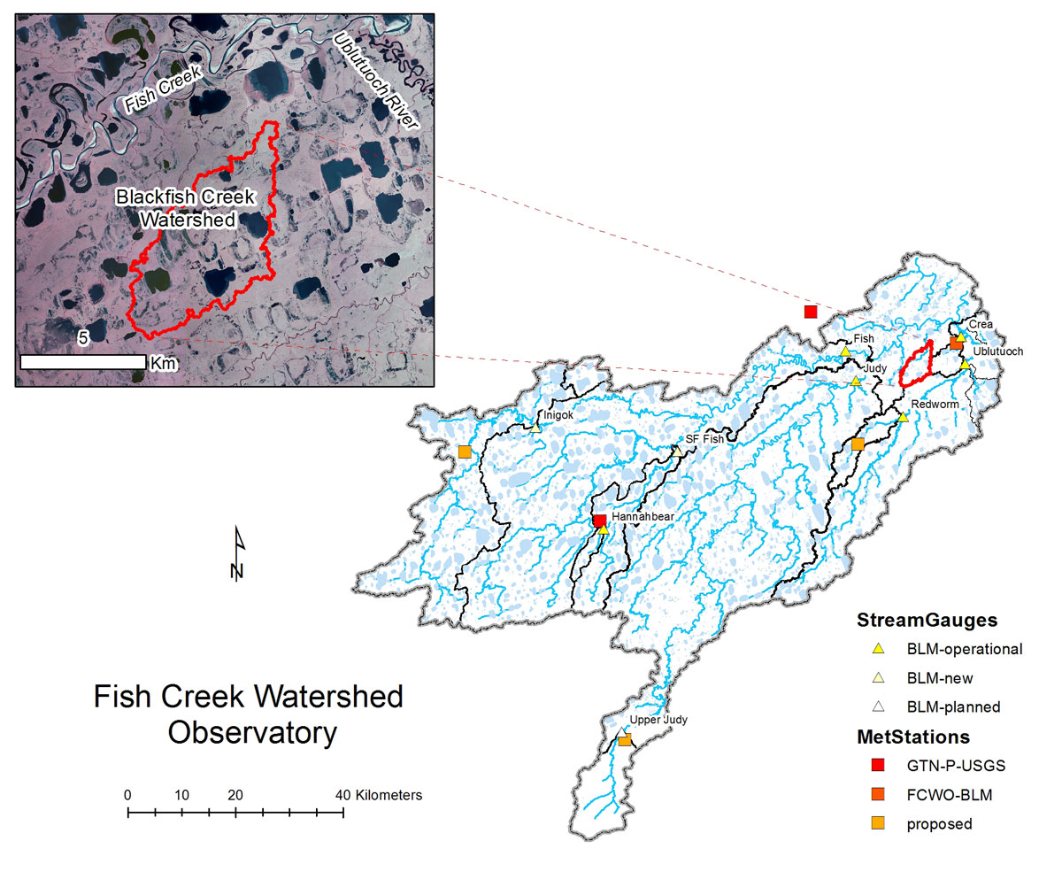
- Station Name:
- Blackfish Creek
- Latitude:
- N 70.279°
- Longitude:
- W 151.484°
- Elevation:
- 6.0 masl
- Drainage Area:
- 22.9 km2
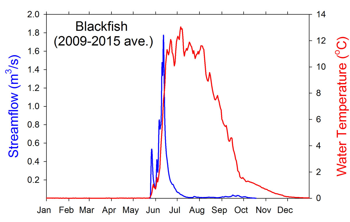
- Record:
- 2009 – present
- Purpose:
This station was established to collect baseline data prior to development of ConocoPhillips Alaska Inc.'s GMT1 (CD-6) project in which a drilling pad is scheduled to be located within upper portion of this watershed. In addition to stream gauging and water quality monitoring, lakes in the upper and lower portion of the watershed have been monitored as part of the Circum-Arctic Lake Observation Network (CALON). The pools of Blackfish Creek are known to be particularly deep compared to other beaded stream systems.
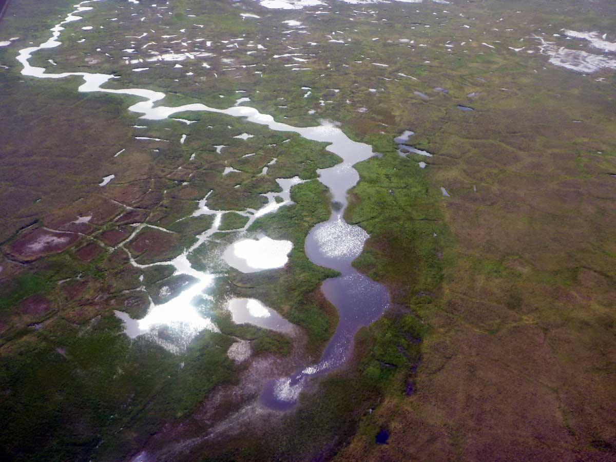
Beaded channel of Blackfish Creek consists of deep coalesced pools formed in ice-wedge networks of polygonized tundra.
Select Published Studies on Blackfish Creek and its Lakes:
- Arp, C. D., M. S. Whitman, B. M. Jones, G. Grosse, B. V. Gaglioti, and K. C. Heim. 2015. Distribution and biophysical processes of beaded streams of Arctic permafrost landscapes. Biogeosciences 12: 1-19.
- Arp, C. D., B. M. Jones, A. K. Liljedahl, K. M. Hinkel, and J. A. Welker. 2015. Depth, ice thickness, and ice-out timing cause divergent hydrologic responses among Arctic lakes. Water Resources Research. DOI:1002/2015WR017362